Trace a Gaines County Property From Surface Parcel to Mineral and Tax Record
Start with Gaines County Appraisal District when you need a property ID, geographic ID, appraisal owner, legal description, preliminary value, exemption, mineral account, agricultural appraisal, business-personal-property account or parcel map.
Gaines County works differently from many Texas counties because the appraisal district also provides the official property-tax payment and collection route for the taxing units it serves. The County Clerk remains the correct office for recorded deeds, liens, plats and certified property documents.
Use the property ID when available; otherwise begin with one name or street field.
302 S. E. Avenue B, Seminole, Texas 79360.
Use the official Gaines CAD payment route and save the confirmation.
Use the County Clerk for deeds, liens, plats and certified copies.
Local links, contacts and procedures reviewed July 2026.
What do you need to do with the Gaines County property account?
Use owner name, address, property ID or Advanced Search, then confirm the legal description and property type.
Follow the search stepsReview land, improvements, market value, appraised value and taxable value, then recheck after certification.
Understand the valuesCompare acreage, market value, productivity value, land use and agricultural or wildlife qualification.
Review land appraisalMineral and business-personal-property accounts can be separate from the surface real-property account.
Find the correct property typeIdentify the exact value, ownership, exemption, acreage or property-detail issue before filing.
Build the protest packetConfirm the property ID, tax year, balance, fee, confirmation and posting status.
Follow the payment workflowSearch Gaines CAD without confusing a surface, mineral or business account
Use the Gaines CAD property-search image as a click guide
The current article included the image below. It is preserved here and placed inside the search instructions where it helps users recognise the official lookup process. The live portal controls, so reopen it before acting on any value or account.
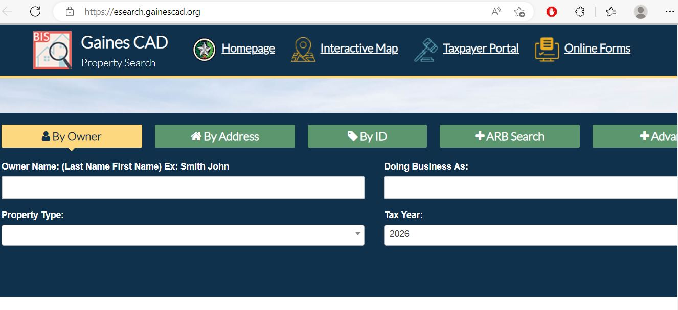
Choose the Gaines CAD filter that matches the property
| Search field | Best use | Verification step |
|---|---|---|
| Owner name | Home, land, business, mineral, estate, trust or company research. | Try the last name alone and compare every property type. |
| Street number and street name | Residential or commercial property with a known situs address. | Remove the number or suffix when a complete address fails. |
| Property ID | A notice, bill, prior account or payment record provides the identifier. | Confirm owner, tax year and property type after opening it. |
| Geographic ID | Matching an appraisal account to a parcel, map or legal-description reference. | Do not treat it as a surveyed legal boundary. |
| Abstract | Rural acreage, farm, ranch or land without a normal street address. | Match survey, abstract, tract, acreage and recorded deed. |
| Subdivision | Property in Seminole, Seagraves, Loop or a platted rural development. | Match lot, block, phase and legal description. |
| Property type | Separating real, mineral, personal-property or mobile-home accounts. | Search every relevant type when researching all owner assets. |
| Mobile-home park | Locating a manufactured home that may not be tied to the land account. | Check whether the home and land have separate ownership. |
| Doing Business As | Business-personal-property accounts using a trade name. | Compare DBA, legal entity, situs and rendered assets. |
| ARB fields | Searching protest status, informal date, hearing date or formal date. | Use the mailed hearing notice as the controlling schedule. |
Understand what a Gaines CAD property account proves
| Field | What it identifies | What it does not prove | Next action |
|---|---|---|---|
| Property ID | The appraisal and collection account in Gaines CAD’s system. | That every related mineral, business or mobile-home interest uses the same ID. |